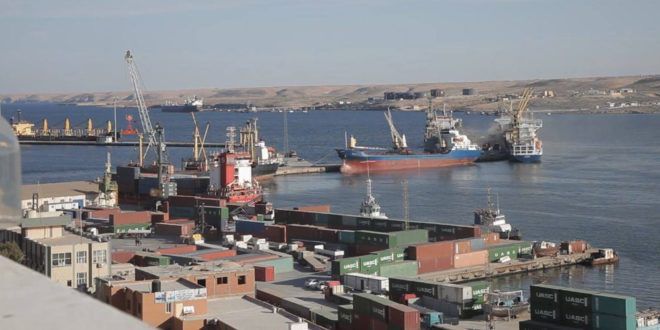
Tubruk Port

Location:
Longitude:
Latitude:
Libya
59.23 E
5.32 N
The port is located in the northeastern of Libya. It is considered the only natural port on the Libyan coast because it is inside a gulf of about 6 square km. It is a shield for waves and strong winds, and east winds blow on it in December and March
The gulf is featured by its entry into the land of about 4 nautical miles with great depths..
On the northwest side of the gulf is the sea and commercial port, and the southeast side there are two berths used for loading and unloading bulk liquids (oil).
Port features:
The total area (680 thousand square meters).
Water area (480 thousand square meters).
Floor area (200 thousand square meters).
Design capacity (absorptive) (1,070,000 tons annually).
For merchandise:
General cargo 500,000 tons per year.
Dry casting 400,000 tons per year.
Contained cargo 150,000 tons per year.
for containers (20000 tons).
The largest ship that can be received (tonnage 50,000 tons).
Working hours:
(24 hours a day) divided into shifts.
Navigational features:
The shipping lane is 2.3 nautical miles long, 350 meters wide, and 15 meters deep.
The turning circle (with a diameter of 580 meters and a depth of 15 meters at the oil berths, and at the commercial sea berths 360 meters and an average depth of 7 meters).
The approach area (there from the north side shows the outskirts of the city and from the south side of the bay a series of medium-rise mountains, and navigational lights guide the ships to enter).
The anchorage area is 2 nautical miles east of the entrance to the gulf.
Pilotage (compulsory for all ships).
Towing (mandatory for all ships over 2,000 tonnage).
Berths features:
| Berth type | Qty | Berth No. | Length | Draft | |
|---|---|---|---|---|---|
| From | To | ||||
| Dry casting | 2 | 7-8 | 240 m | 8 | 8.5 |
| General cargos | 4 | 3-4-5-6 | 600 m | 5 | 7 |
| Containers | 2 | Loading and unloading of containers | |||
| RO-RO | 1 | 9 | 90 m | 7 | 8.5 |
| Anchorage (fishing boats) | 2 | 1-2 | 220 m | 4 | 5 |
Distribution of Marine Units :
No | Unit Name | Unit Type | Horse power |
1 | Almukhtar | Tug Boat | 2720 |
2 | Alnadorah | Tug Boat | 3350 |


